
6 October 2015, Tuesday
The breakfast room at the Redcastle is spectacular—it sits right on the water and that wall of the room is almost entirely glass. Every morning we were there, I was fascinated by the rising sun and the views of Lough Foyle, either misty or clear. Stunning. (Though occasionally too much—on the sunny days, you might find yourself squinting.)

Watching the sun come up from the Redcastle dining room on the 6th October.
The breakfast room is always an interesting point of comparison from one hotel to another; we’d explored every dining option at the Portmarnock, so this was a new adventure. Different brands of white and black pudding, for example. And you could order trout or omelets from the kitchen.
Last time we were on Inishowen—Inis Eoghain (Eoghain’s Island)—we just spent one night, and didn’t have a lot of time to really explore. I wasn’t going to let this opportunity lapse a second time. I’d done my research, and I had a list. 🙂 We had a few days to see it all. Maybe.
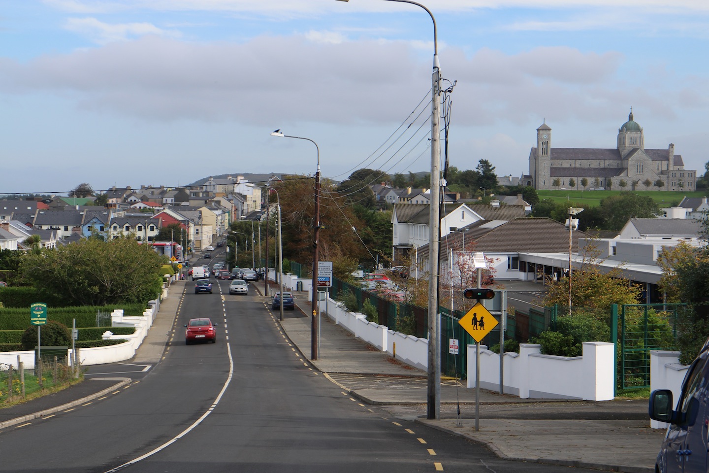
So off we went, driving a couple miles north up the coast to Moville. Dropped into a bookstore and picked up a map and a guidebook about the Wild Atlantic Way. (It’s a tourism thing.)

The R238 runs through Moville.
“[Moville’s] most attractive feature,” Wikipedia tells us, “is its handsome Green, a large seaside park in the Victorian style which features bandstands, walking trails, playgrounds, a coastal footpath and sweeping views east across the waters of the lough to Northern Ireland.”

Looking north from the green in Moville.
We walked down to the green, in fact, though we didn’t go further. We were on our way to Malin Head. When we’d been here in 2003, I’d left Gerry watching a soccer game and gone off on my own to find the head—the most northerly point on the island of Ireland. (Oh, sure, the west coast of Scotland is up there. And the Faroe Islands, and Iceland and Greenland, before you get to the polar ice cap … but still.) But this was before GPS, even, really, before Google Maps. Certainly before the Wild Atlantic Way and the Inishowen 100, which between them have signposted every single little thing.

It would have been nice to have had one of these twelve years ago. 🙂
What I’m saying is, I didn’t actually find it in 2003. I drove along the northern coastline (the R242), though. 🙂
The terminology doesn’t help. What is a “head”? It’s often a point on the coast with a lighthouse sitting on it, though in the case of Malin Head that is not a true statement. It is a piece of land that projects out from the coast. And in the case of Malin Head, there is a high point (a hill, if you will), called Banba’s Crown, upon which sits a Martello tower. I had seen none of this in 2003. And if you follow your GPS, you likely won’t see it, either. Hence the purchase of the paper map.

If you follow the GPS, you’ll end up here.
Lovely view, though. We got out of the car, walked across the field.

And, well, here he is, outstanding in his field. 🙂 (John took this photo.)
Then we started looking around. First …

A very old culvert.
And then: ooooooh … there it is. The Martello tower atop Banba’s Crown. West of us.

Banba’s Crown in the distance. On the left you can see the little one-lane road lined by rock walls.

Just for comparison, here we are at Banba’s Crown, looking east, from whence we’d come. We were beyond the “finger” sticking into the sea.
So we drove right up to it, parked in the lot below, and walked up to the tower, built in 1805 by the British to guard against French invasion during the Napoleonic Wars.

The Martello tower at Malin Head.

John took this one of Gerry and I.

John at Malin Head.
There’s a trail along the cliff, with all the appropriate warnings about no children, don’t get close to the edge, beware the winds, and so on—it was very windy—and John wandered down a little of it.

John took this photo of the trail along Malin Head, which he called “tame,” at least in this stretch.
Meanwhile, Gerry and I took photos, including one of Ballyhillin Beach, which is a “raised beach,” meaning it’s still there when the tide is high, as it was this day. This is because it was formed about fifteen thousand years ago, when the glaciers began to melt and sea level was much higher. It’s a pebble beach, studded with semiprecious stones, it’s said. (One website I checked said it’s against the law to remove the stones, but—seriously? You’d really have to know what you were looking for.)

Looking east, that’s Ballyhillin Beach.
Just below the tower, you can see the word Eire spelled out in stones, put here in 1942-43 because Ireland was a neutral state; if Germans were going to bomb, they needed to move on down the highway to Scotland. Just three years earlier a Coastal Watch had been established to guard against invasion by the Germans; Malin Head was number 80. Allied pilots used these as navigational aids.

The Eire 80 sign.
Malin Head is an important mavigational point for other types of pilots too. Only ocean lies between it and the Americas, so Malin Head provides a welcome resting point for migrating birds. This landmark also helps them locate feeding grounds around the loughs (Swilly and Foyle).
John wasn’t gone but a few minutes, and we walked back down the hill and drove on. Of course, we immediately came upon a little junk shop, at which it was imperative that we stop. I bought a piece of Royal Tara bone china—a little cream pitcher. The company was started in Galway in 1953 and closed rather abruptly in 2003, to much disappointment. My little pitcher—creamy white with shamrocks scattered around the top; I paid just €7 for it—is missing the matching sugar bowl, but a search around on the web indicates a sugar/creamer pair is valued at $50.

The Curiosity Stop. Of course! (John took this one.)
We drove back down to Malin village on R242 along the shallow Trawbreaga Bay (at low tide you can see just how shallow).

Looking across Trawbreaga Bay at high tide.
Malin is a seventeenth-century plantation village—plantation meaning the British brought in settlers to colonize the countryside away from the native Irish—with pretty features such as its ten-arch bridge and the triangular green in the center of town planted with lime, cherry, and sycamore trees.

John and Gerry getting ready to walk across the green to the grocer (in search of green teabags).

More of the pretty village green, with the Church of Ireland in the background.
Gerry and I spent a night here twelve years ago at the Malin Hotel, and remembered the experience with delight—particularly the wonderful meal we had in the pub (and the Molton Brown amenities in the room, which were the start of a lifelong and not inexpensive Molton Brown habit)—and all of us were ready for lunch. But when we got there, the sign on the hotel was faded, and, in fact, it was closed for the season. A man working nearby told me it was only open on the weekends even during the summer. (sigh) There was no joy at the grocer, either. Green tea is hard to find in the more remote places (i.e., on the Inishowen Peninsula).
So … we were still hungry and still needed to replenish our green tea supply. Off to Carndonagh, a couple miles away. I’ve since read that Buncrana is the largest town on Inishowen (pop. 6800), but when we drove into Carndonagh—remembering the burgh we’d seen in 2003—we were shocked.
How large you’ve grown, Carndonagh!
That’s the Church of the Sacred Heart up there on the hill. I got a kick out of this somewhat snippy commentary from this architectural site (from which I’ve gotten a lot of good information over the years)—
Large Roman Catholic church that proclaims its position over the town and countryside. Done in a vaguely Italianate style with the campanile and crossing tower and dome, described as “Neo-Italianate” at the time. Clearly an example of the mid-century church building in Ireland, as epitomised by buildings of the period in Dublin – vast, lacking in architectural detail, and historically dubious.
—partly because I’ve seen new churches built here in Tennessee that I would call “historically dubious” (and, frankly, ugly too).
There’s a historically very important (seventh century) cross in Carndonagh, right on a main street. We’d seen it in 2003 and thought it would be easy to find, but what with urban sprawl, we weren’t having any luck. We pulled into a parking lot to reconnoiter and realized there was a good-sized grocery store there, and when we went inside, we also found a little restaurant. So we had a pause, found the cross on a paper map, and went back.

The Carndonagh Cross, October 2015.
This is one of the earliest and most important high crosses in Ireland. To understand why, you need to know that before the tools had been invented to carve stone into three-dimensional shapes, humans simply carved outlines on stone—like line drawings on paper. So you had a slab of rock and you scratched out a picture on it. This article at Megalithic Ireland (in addition to having much better photographs than mine*) explains, “This early Christian cross is thought to represent the transition from crosses carved on slabs, such as that at Fahan Mura, to a slab that is cut out in the shape of a cross” (emphasis mine). Do read this article. Note that unlike later high crosses that depicted Christ at the point where horizontal and vertical crossed, here he is further down, on the shaft. (Here’s another interesting article, with photos likely taken several decades ago.)

This is the other side of the Carndonagh Cross, flanked by the two pillar stones, with Gerry in the background. You can see in the pillar stones, how the artist would simply use unshaped (or barely shaped) stone, upon which he’d scratch out a drawing. That’s King David with his harp on the left.

Here’s David holding the harp, closer. It was an imprecise art, trying to find a suitable stone. This pillar has, perhaps, three sides, with a fourth side too small to draw on.

A better look at the crucified Christ in the center of the cross’s shaft.

Here are those three figures—possibly the women who discovered the empty tomb—at the base of the cross.

This is on the opposite side of the Psalmist: David the warrior. Or, perhaps, Goliath. Who knows?
Inishowen is a small place. We crisscrossed the peninsula several times over the days we were there. On this particular day the shadows were growing long and we meandered back to the hotel—because I had a 5pm appointment in the spa for a foot and leg treatment.
It was wonderful. Worth every penny, and the young woman who did the work was a delight to chat with. I asked her for a restaurant recommendation in Moville and she gave me one we would try out the next day.
And that was the day. Gerry and I made an early night of it.
* It helps when you have professional lighting!
